A new Presidential Decree (Government Gazette D’ 129/2025) establishes a comprehensive and unified framework for the spatial classification and regulation of settlements in Greece. The decree introduces three internal zones — Zones A, B, and B1 — defined according to the period and pattern of development, with the primary objective of protecting historic settlement cores and highlighting the unique identity of each locality.
In parallel, it introduces a classification system that organizes settlements based on morphological, demographic, and geographical criteria. This approach enables a more targeted application of building regulations and land use rules. Traditional and historic settlements, which until now operated under unclear legal conditions, are given particular attention under the new framework.
While this initiative seeks to correct long-standing irregularities, it has also sparked public debate, particularly over its strict focus on pre-1983 development. This focus excludes many legally built properties and neighborhoods that have developed over the last four decades, especially in informal extensions of settlements. As a result, hundreds of properties, whether in sparse or dense configurations, are effectively left outside planning boundaries—raising concerns about perpetuating spatial injustice.
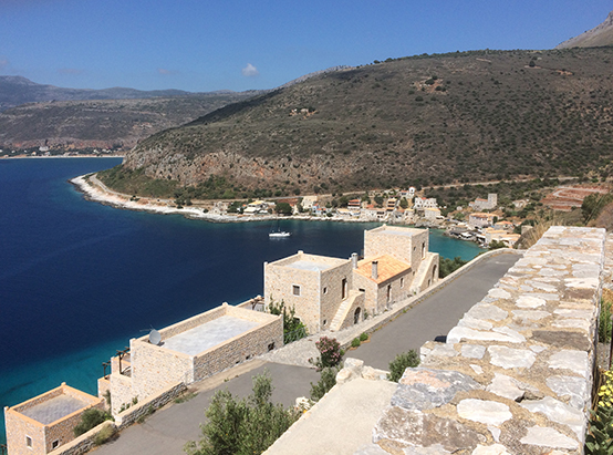
The decree introduces a structured and uniform delineation system for all settlements that meet the established population and temporal criteria. Settlements are evaluated according to their geographic location (mountainous, lowland, or coastal), population size, architectural and morphological features, and their functional role within the broader territory, such as whether they are tourist destinations, suburban extensions, or dispersed communities. Depending on this classification, specific building conditions and permitted land uses are applied, with the overarching aim of preserving the distinct character of each settlement.
A key innovation is the division of settlements into three internal zones. Zone A covers the historical core of the settlement, developed prior to 1923. Zone B includes the compact areas developed between 1923 and 1983, while Zone B1 refers to the scattered or loosely developed parts from the same period. Delimitation is based on detailed technical and census data, historical aerial photographs, and official cartographic materials, ensuring a scientifically grounded and transparent process.
The decree also sets out clear building regulations for each zone. In Zone A, buildable plots must be at least 2,000 square meters with a minimum frontage of 15 meters, although in mountainous or semi-mountainous areas, this threshold is reduced. Exceptions are made for smaller plots that were legally established before 1981 or 1979. Zones B and B1 allow for buildability on plots ranging from 300 to 2,000 square meters, depending on the urban fabric. Across all zones, the maximum allowable coverage is 60%, while building coefficients vary depending on plot size and land use. A tiered system applies in larger plots to avoid overdevelopment.
Land use permissions are also defined per zone. Zone A supports primarily residential uses, as well as small commercial activities and tourist accommodations. Zone B allows for additional functions such as schools, cultural centers, and public services. Zone B1 is oriented toward low-impact activities, including agricultural uses.
The decree explicitly excludes specific types of land from settlement boundaries, including forested or reforested areas, archaeological sites, environmentally protected zones, high-productivity agricultural land, coastal areas, beaches, and geologically unsuitable terrain. If any portion of a settlement is classified as landslide-prone or particularly vulnerable to natural disasters, its inclusion requires a dedicated geological suitability study.
Implementation of the delineation process can be initiated either by the relevant municipality or the Ministry of Environment. This may occur within the framework of Local or Special Urban Plans or through an autonomous Presidential Decree. Public participation is a cornerstone of the process. Planning studies must be made publicly available, and residents, stakeholders, and institutions are invited to submit objections or comments before final decisions are made.
Notably, the new framework introduces important planning tools, such as mandatory land cession to facilitate the expansion of public spaces, provisions for the establishment of building lines or restricted development zones, and the delineation of coastal settlements under special terms to better manage their unique characteristics.


