The Special Town Planning (STP) is part of the 'Konstantinos Doxiadis' Town Planning Reform Program, funded by the Recovery and Resilience Fund. It represents the first stage of town planning for the Municipal Units of Upper Mykonos and Mykonos.
Through the EPS study, a model for the spatial organization and development of the Municipality of Mykonos is proposed, outlining guidelines and regulations for both the rural areas and the settlements within the municipality.
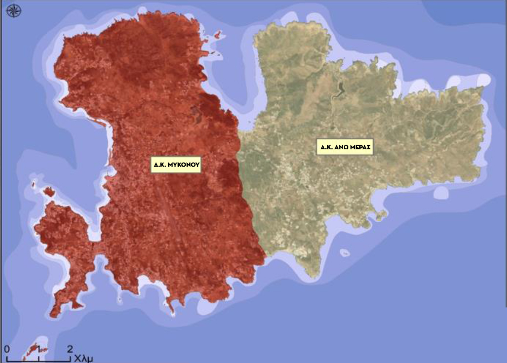
Here’s an improved version of your text with enhanced clarity, structure, and flow:
The organization of the extra-urban area primarily concerns the island of Mykonos, as the surrounding islands—Delos, Rhineland, smaller islands, and rocky islets within the Municipality—are subject to environmental and archaeological regulations. These areas are governed by specialized studies and legal restrictions that prohibit construction.
At the heart of this process is the preparation of the Urban Planning Study (UPS), which outlines the spatial organization and development strategy for the area. This study defines key elements, including the boundaries of urban planning units and settlements, land use designations, building conditions and restrictions, essential urban planning interventions, and the infrastructure for both motorized and non-motorized transport. It also addresses technical and environmental networks, prioritizes the road network, and outlines plans for emergency response and risk management, including temporary delimitations for watercourses in areas to be urbanized. Additionally, the study identifies geologically suitable areas for development within the project area.
A dedicated chapter also focuses on measures to mitigate climate change and manage climate-related risks, ensuring that the urban plan is resilient to future challenges.
The study begins with a thorough examination of the existing urban planning conditions in the Municipality, including demographic, economic, and business profiles, the current built environment, sustainable mobility practices, public infrastructure availability, and the adequacy of public spaces. It also evaluates the Municipality's climate resilience. By considering these factors alongside regional and national strategic plans, the study presents the chosen scenario for organizing the urban and peri-urban environment. This includes land use allocations and building regulations that will directly impact the daily lives of residents.
Core EPS guidelines
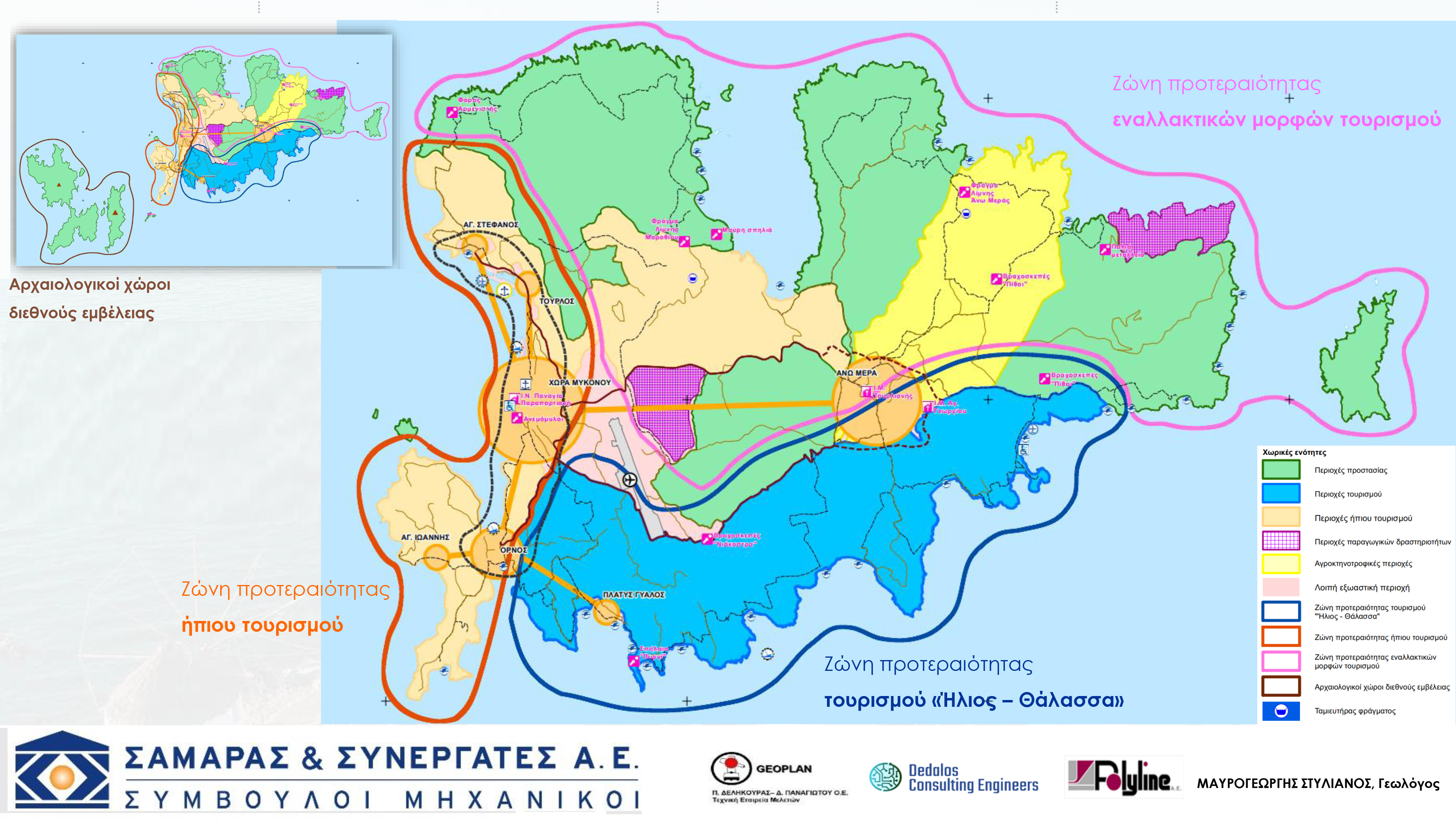
The proposal for the EPS Mykonos seeks to find a balanced approach between the need to protect the natural environment and the demand for tourism development, in harmony with the overarching planning objectives.
Key Protection Zones (PES) are proposed to safeguard critical areas, including the Natura 2000 network, wildlife refuges, island wetlands, and reservoirs. Additionally, the plan aims to protect streams and riverside vegetation, archaeological sites and monuments, areas of significant relief and landscape value, as well as valuable beaches and swimming areas.
In parallel, Land Use Control Zones (LUSEs) are designated for specific purposes. These include areas for storage, processing, and waste management facilities, which are further divided into two sub-zones. Other zones are proposed for tourism and recreation in the southern areas of Mykonos, as well as for mild tourism activity along the island's west coast, the Diakoftis Peninsula, and the Marathion reservoir area. Agricultural and livestock activities are concentrated in the Ano Mera region, while the non-urban areas of Chora Mykonos are also designated for specific use.
At the heart of the proposal is the creation of a unified zone for tourism, recreation, and holiday homes in the southern part of Mykonos. The remainder of the island is primarily envisioned as a protected area, with a focus on promoting sustainable and alternative forms of tourism that respect and preserve the island's natural and cultural heritage.
